Yay for Chaos Theory!

Saturday, November 20, 2010

Snow on the way


Of the five models I regularly look at, every single one of them now gives us here in Portland at least a little accumulating snow.

The GFS is the only solution that's further inland with the trough now, and even it gives us enough moisture to squeeze out up to an inch of accumulating snow. The UKMET, ECMWF, GGEM (Canadian), and NAM models are all further west with the trough, inducing a stronger surface low and much more moisture. The NAM, at face value, gives the Portland area at least 2-5" of snow, and the other models generally look like the NAM.

Afterwards it gets cold, with 850mb temperatures down to the -12 to -14C range. With snow on the ground, I wouldn't be surprised to see even the Portland Airport get down to the lower 20s, or even (*gasp*) the upper 10s.

Enjoy the snow and cold!

Thursday, November 18, 2010

More Musings on Cold and Snow


What a change a day makes. Last night's 00z models were somewhat disappointing for us here in the Pacific Northwest, sliding the brunt of the cold (and all chances of snow) off to the east. The 12z Euro reinforced that idea.

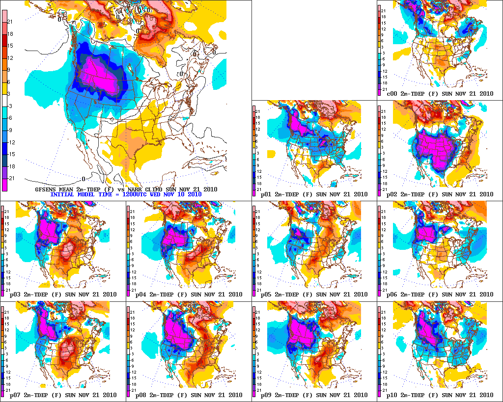
But some magic has been happening in model land today, and the clear trend in the ensemble mean couldn't paint a better picture. In the four runs since and including the 00z GFS, the coldest 850mb temperatures for the ensemble mean in Portland have been -7C, -9C, -10C, and on the latest 18z ensembles, as shown above, -12C. That is an incredible ensemble mean for a time period less than 5 days out. Seattle, likewise, has trended, respectively, from -9C, -13C, -13C, -16C. Wow!

With the further west solution, the 18z GFS produces another area of low pressure along the coast after the initial cold surge Sunday night. As this drops southeastward, moisture associated with the low dumps quite a bit of snow in the northern and north-central Willamette Valley. This is just one run and specifics will change before all is said and done, but our chances for snow on Monday are now much higher than they seemed 24 hours ago.

Tuesday and Wednesday will likely be dry with a ridge building in, but should still be cold with east winds through the Gorge (and a remaining cold airmass over Seattle). There's no agreement on how or when we transition out of the cold. It could just be a gradual warm up with dry conditions, could be a messy overrunning snow or ice storm, or somewhere in between (moderating, then just rain?).


In the closer-range, it appears there is an outside chance that someone in Northwest Oregon or Southwest Washington could see a band of snow set up Saturday night. A band of moisture swinging around the low offshore could stall out in the area, and with heavy enough precipitation rates and a cold airmass, not to mention light offshore flow in the Portland area, we could see the same type of "surprise" we saw last night, where snow levels were a good 1,500 feet below predicted in the heavier bands of precipitation. Except this time, that would take the snow level all the way down below 500 feet... possibly near the surface. It would be a very borderline thing, but the potential is there.

Wednesday, November 17, 2010

Cold and Snow!

Above is an image of the day 6 GFS ensembles and ensemble mean from the PSU e-wall site.

What does it show? It shows that the least impressive scenario is cold and dry (highs in the 30s, lows in the 20s for Portland). The most impressive scenario? Very cold and snowy (several inches of snow, highs in the upper 20s, lows in the 10s). And you thought this was November!

Some of the ensemble members would give us a white Thanksgiving, with snow falling in the Sunday-Tuesday timeframe, and then dry and cold thereafter (the 12z GFS even hinted at another possible low sliding down the coast and spinning in a little more moisture on Wednesday/Thursday).


So what does it all mean? We're gonna get cold. And we'll probably at least see a little snow. The details are still not settled, but at this point it's safe to say my mid-late November "Arctic outbreak" is a go! ^_^

Saturday, November 13, 2010

Now that's what I call an ensemble mean plot!


That's day 7, by the way.

Two questions...

1. How cold will it get?
That depends on how long it takes to move the trough along the BC/WA/OR coasts (associated with the SSW digging vort-maxes) down south and east of the region. If it moves out quick enough, the brunt of the cold air will come straight down over Seattle and Portland. I'm banking on a slower solution, allowing the modified remains of the cold air to punch their way in. Seattle will probably have at least a day or two with highs below 35°F, and lows in the lower-to-mid 20s. Portland... not sure yet. I'd guess next Sunday or Monday will have a high in the lower to mid 30s, with lows in the mid 20s.

2. Snow?
Definitely, probably, and maybe. Definitely in Bellingham. Probably in Seattle. Maybe in Portland.

Wednesday, November 10, 2010

Arctic blast: Confirmed!


Obviously it's not 100% certain since it hasn't happened yet, but models have been extremely persistent about sending a Polar Vortex into Canada (at least), and blasting much of the northern tier of the US with "Arctic air" (however Arctic that can be in November).

How far west/east this cold air makes it is still a major question mark, but lots of model runs/ensemble members do bring the Arctic air into the Pacific Northwest at some point or another. The most favorable thing, in my opinion, is how long the large blocking ridge off the coast is expected to last. This should give Seattle/Portland numerous opportunities for cold shots, with snow a distinct possibility at times. If we can time a shortwave perfectly to coincide with the sagging south of a lobe of the polar vortex (and associated strong Arctic high just to the north), we could see a true Arctic outbreak in the Pacific Northwest (think November 1985 or 1955). That's still a relatively unlikely event, but that it's even a possibility is somewhat impressive.

One potential outcome is that the cold might be hung up at some point on its southward journey. Will it be north of the Canadian border? Seattle? Will it make it all the way to Portland? Will cold air east of the Cascades filter through the Gorge to Portland? These are all specifics that will have to wait several days, at least, for an answer. Until then, buckle up and enjoy the model ride!

Thursday, October 28, 2010

Forecasting the first "Arctic Blast" of the season


... okay, maybe the title is a bit extreme. But two of my three favorite "analog years" (1955-56 and 1964-65, but not 1998-99) featured a cool-to-cold period in mid to late November. Moreover, the pattern we've been in through October occasionally leads to such a cold shot down the line.

Add to those little hints that the GFS ensembles (and the latest 12z operational, though that's not really fair since it's basically meaningless) are starting to like the idea of an Aleutian blocking ridge and a downstream trough over the Pac NW in the 11- to 15-day range, and there are at least some signs that the northern tier and Pac NW could see a cold shot this November. Now, often when the GFS ensembles begin advertising a significant pattern change, they are way too quick to do so. Usually it seems that an "actual" pattern change occurs a week or two after the models initially showed it. That's why I say the best chance would be mid-late rather than early-mid November.

Typhoon Chaba to become potential Pac NW windstorm threat


It's still very early, and there are lots of different scenarios that could potentially play out in the end... but the GFS has recently been flirting with the idea that a chunk of energy from former typhoon Chaba will cross the Pacific, arriving just south of the 40N, 140W benchmark by day 7 (on the heels of another moderately strong extratropical cyclone further north). Developing/bombing storms south of this benchmark are much more likely to make landfall on the Washington or south Vancouver Island coast, bringing the potential for a windstorm to the big cities of the Pac NW.

As of now, dynamics look favorable for a strengthening system and minor/moderate windstorm for Seattle/Portland. However, 850mb baroclinicity and jet strength, while indicative of a strengthening storm, are, at face value, not enough for a true major bomb a la Dec 1995 or Oct 1962. But it has certainly piqued my interest, and I'll be tracking this one closely until the models drop it.